
You’ve seen the postcards — Uluru standing tall, blazing red against a blue-sky backdrop. But maybe you’ve also heard the whispers: “Most of Uluru is actually underground.“ So, is it true? Is Australia’s most iconic monolith mostly hidden beneath the desert sand like some kind of geological iceberg?
Let’s clear the air (and the dust) with facts, field knowledge, and a few cheeky truths you won’t get from the tour brochures. If you’re already planning your Red Centre escape, consider pairing your visit with a trip to Kings Canyon or Kata Tjuta — both are stunners in their own right and just a few hours away.
Contents
How This Aussie Icon Formed
Before we start digging — figuratively, of course — it helps to understand what Uluru actually is.
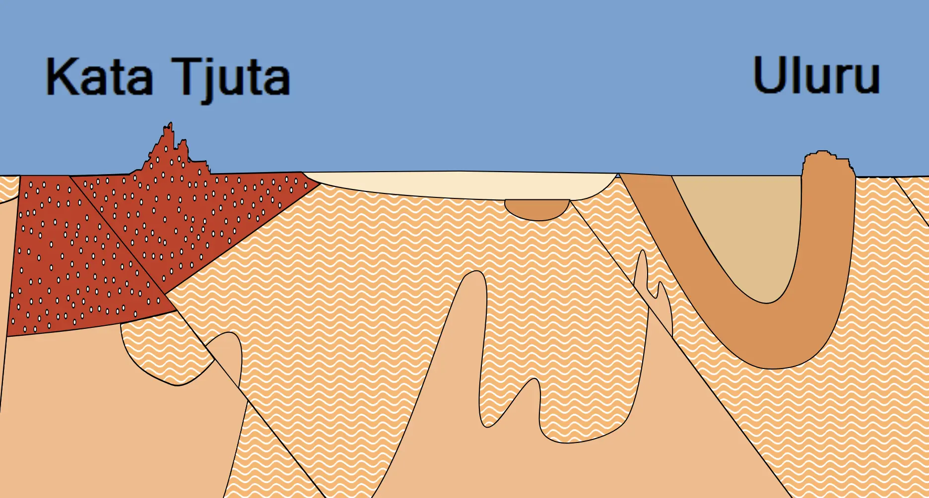
Uluru is a giant sandstone inselberg — a kind of isolated rock hill that rises abruptly from a flat plain. It’s made mostly of arkose, a coarse-grained sandstone rich in feldspar. That’s its primary rock type, and it’s estimated to be over 500 million years old. That’s right — Uluru’s been around longer than the dinosaurs.
The part we see above ground today rises about 348 metres high (that’s taller than the Eiffel Tower, mate) and spans a whopping 3.6 kilometres in length. But the real kicker? Geologists reckon it continues underground for several kilometres more — up to 6 km deep, by some estimates.
So yes, technically, most of Uluru could be underground. But it’s not quite the buried treasure some myths make it out to be.
Fact vs. Fiction
There are a few reasons this idea has taken root:
- It looks like a tip of something bigger. With its sheer, smooth sides and lack of surrounding hills, Uluru gives off strong “iceberg” vibes.
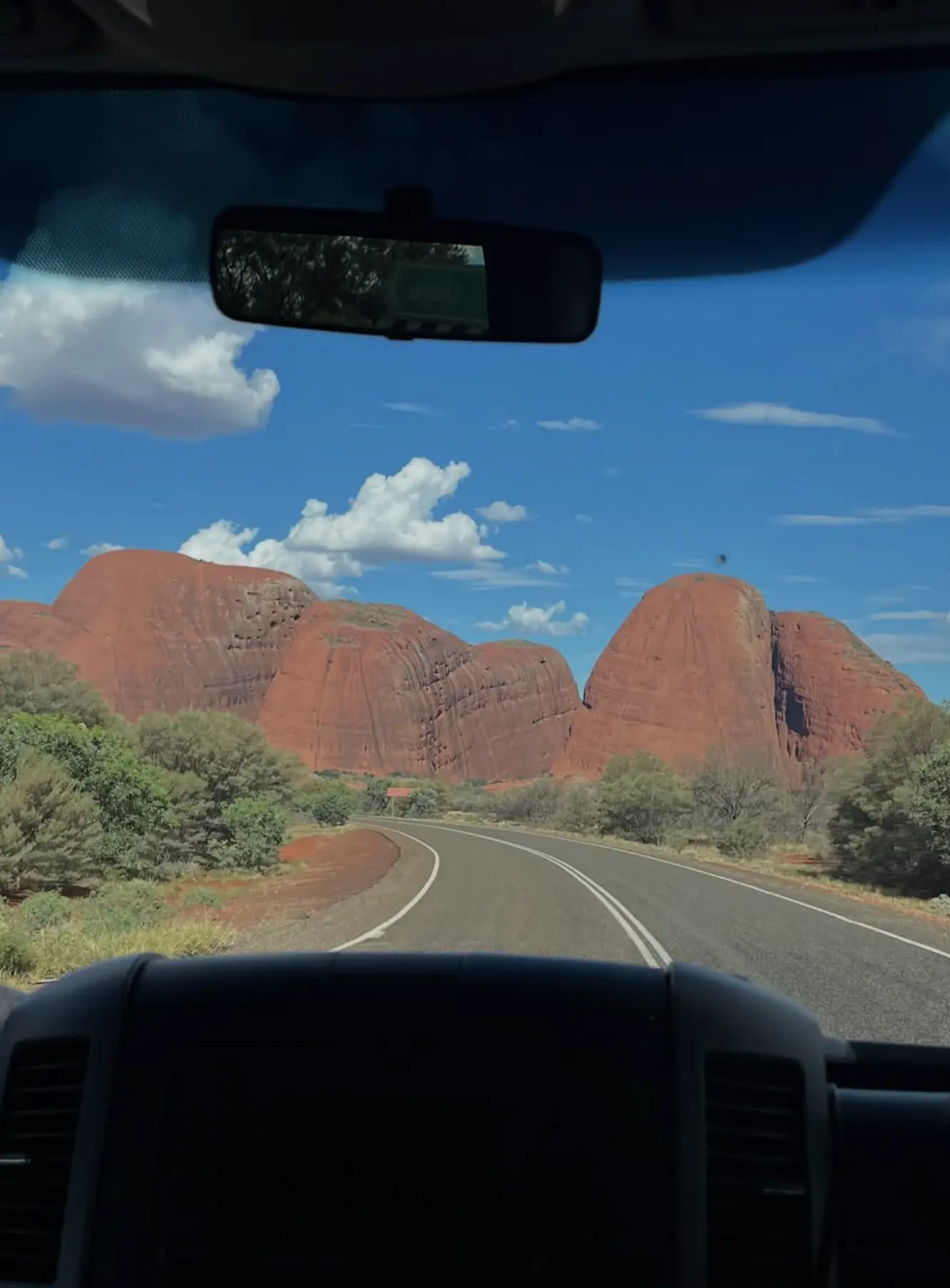
- Its geology connects to a broader formation. Uluru is part of the same sedimentary structure that formed Kata Tjuta (those other big domes nearby) and even stretches into the Petermann Ranges.
- Anecdotes fly faster than facts. Once someone on a tour said, “They say it’s 90% underground,” and boom — the myth spreads faster than a bushfire in the dry season.
But it’s not buried in the traditional sense — it’s not like the rock fell into sand and got swallowed up. It’s that the land around it has eroded away, and what’s left poking out is just the exposed bit, once covered in layers of sand.
So… Is It True or Not?
Yes — but with context.
- Uluru extends underground, likely for kilometres.
- The formation is part of a much larger geologic structure that’s mostly hidden beneath the surface.
- However, the visible part isn’t just a small tip — it’s a massive chunk of rock in its own right.
So, if you’re picturing a 10% tip and 90% submerged mega-rock like an iceberg, you’re off track. But if you imagine an enormous rock formation, much of which lies beneath the earth due to natural erosion and geological processes, you’re on the money.
A Powerful Ground-Level Experience
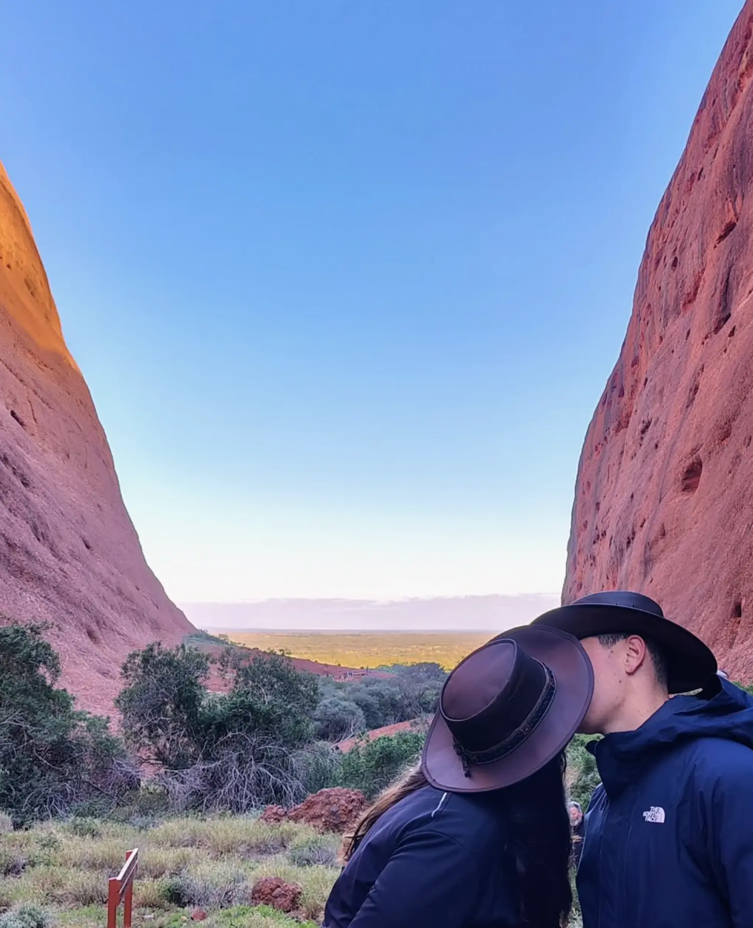
When I first camped near Uluru back in the early 2000s, I remember the moment I stood close to its base — it felt less like a rock and more like a wall. A presence. There’s an energy in the place that photos just don’t capture.
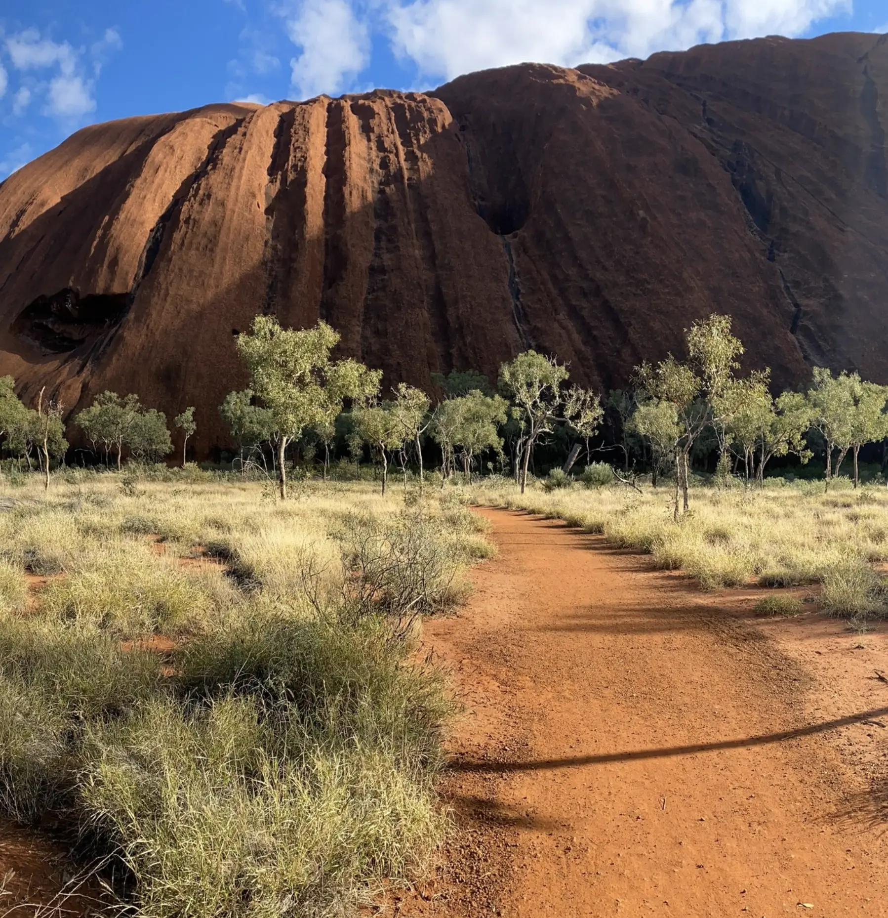
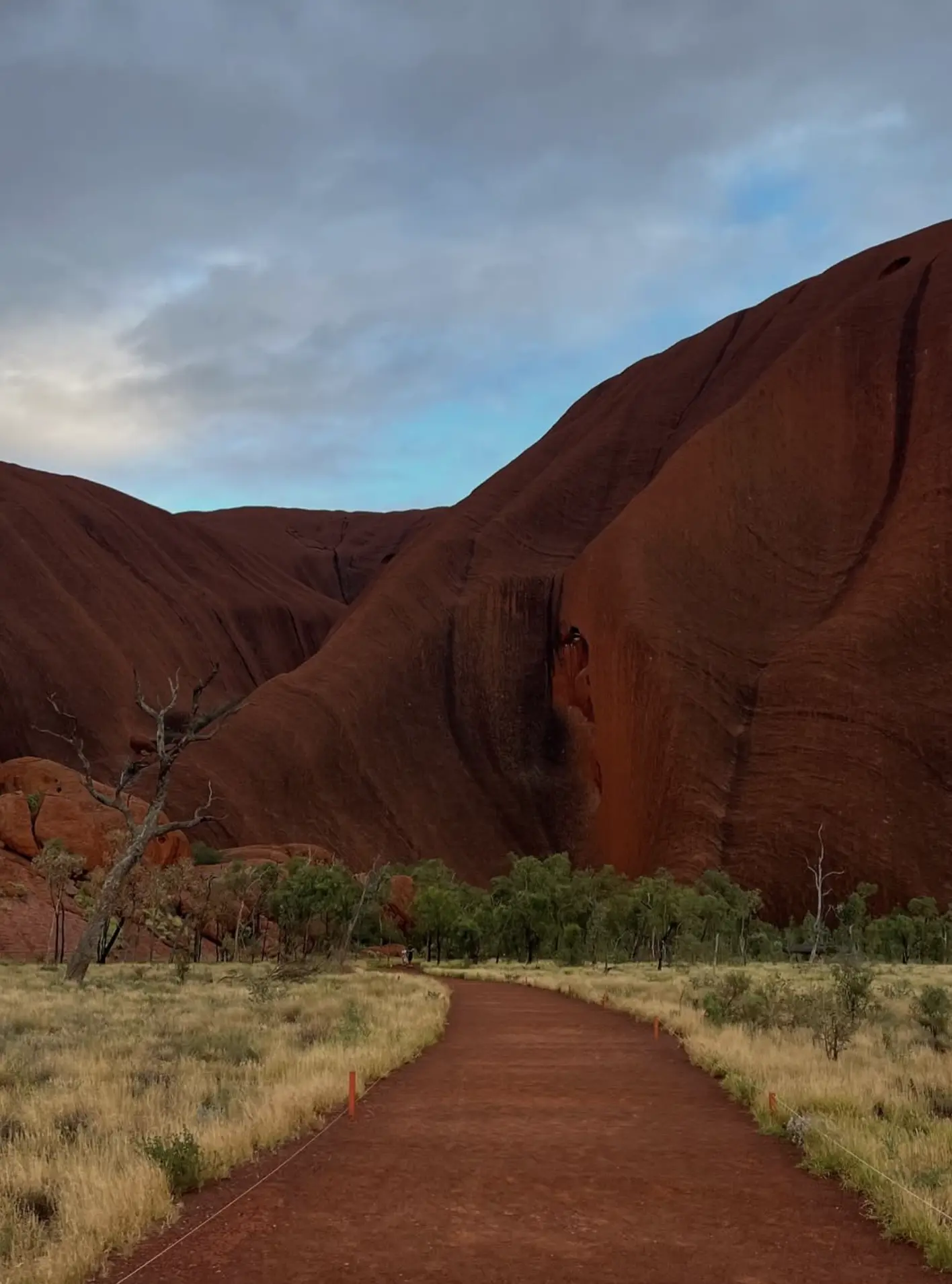
You can walk around the base (a 10.6 km loop) and see its changing textures — honeycomb erosion, ancient rock art, even waterholes tucked into shaded crevices. The surface itself tells a story that goes far beyond what lies beneath. After heavy rains, it transforms — streams trickle down its sides, pooling into temporary waterholes, and the dry earth turns to mud after rain.
You’ll also notice an incredible diversity of endemic plants — many of which only thrive in this part of the outback. These subtle details are part of what makes Uluru such a unique tourist attraction and a crown jewel of Australia’s national parks.
We often recommend pairing your Uluru visit with Kings Canyon Rim Walk or a day exploring Watarrka National Park. Both spots offer dramatic escarpments, shady gullies, and that feeling of having the outback almost to yourself.
If you’re travelling with Autopia Tours, you’ll often find they bundle these nearby stops into their multi-day itineraries — a great way to tick off the best bits without stressing the logistics. Many of their Uluru tours start from Alice Springs and offer excellent local commentary and cultural context.
Trip Planning Tips
When to Go
- Best Time: May to September (cooler temps, fewer flies, more comfortable walks)
- Avoid: December to February — it’s bloody hot, with highs often topping 40°C and the average rainfall spiking with summer storms
Getting There
- Fly into: Ayers Rock Airport (Connellan Airport)
- Drive: About 450 km from Alice Springs (allow at least 5-6 hours)
If you’re short on time or not keen to drive, there are plenty of Alice Springs to Uluru tours that take care of the whole lot — transport, park entry, food, and even swags for sleeping under the stars.
Park Access
- Uluru-Kata Tjuta National Park Pass required (about $38/adult for 3 days)
- Open from pre-dawn till evening — great for sunrise and sunset viewing
- Facilities include water stations, restrooms, and a solid tourist facility near the Cultural Centre
Respect the Rock
- No climbing. It’s been officially closed since 2019, out of respect for Anangu traditional owners and their law.
- Stick to marked tracks. Some areas are sacred and not for photography.
- Learn the stories. Join a guided cultural walk — the Mala Walk is a favourite. Some tours, like those with Autopia Tours, include Anangu-guided walks that really enrich your understanding.
A guided Uluru tour is a great way to access the deeper meaning behind the landmarks — not just the lookouts and photo ops.
If you’re coming in from Alice, consider one of the many well-rated tours from Alice Springs to Uluru — they make a long drive feel like part of the experience.
Cultural Layers Beneath the Stone
Uluru isn’t just a big rock. For the traditional owners, the Anangu people, it’s a deeply sacred place, rich with Tjukurpa — the cultural law and process of creation that shapes life, lore, and land.
When we run eco-tours out here, we always start with the same message: You’re not just visiting a landmark — you’re entering someone’s living history.
Ask a Traditional Owner about the stories embedded in the stone, and you’ll see how little your GPS map really tells you. What you learn will make you rethink what it means to stand on Aboriginal land — especially as a white person.
There are tales of ancestral beings — forms of people — who shaped the land during the creation period. Every crease in the rock, every cave and waterhole, holds meaning passed down through countless generations.
Next time you’re out here with Autopia Tours, ask your guide to share some of the Dreaming stories tied to Kata Tjuta — they’re every bit as powerful and layered as those found at Uluru. If you’re planning a more immersive tour to Uluru, be sure to leave time to sit, listen, and let the place teach you something.
Fun Rock Facts to Impress Your Mates
- Uluru is taller than the Sydney Harbour Bridge and the Statue of Liberty
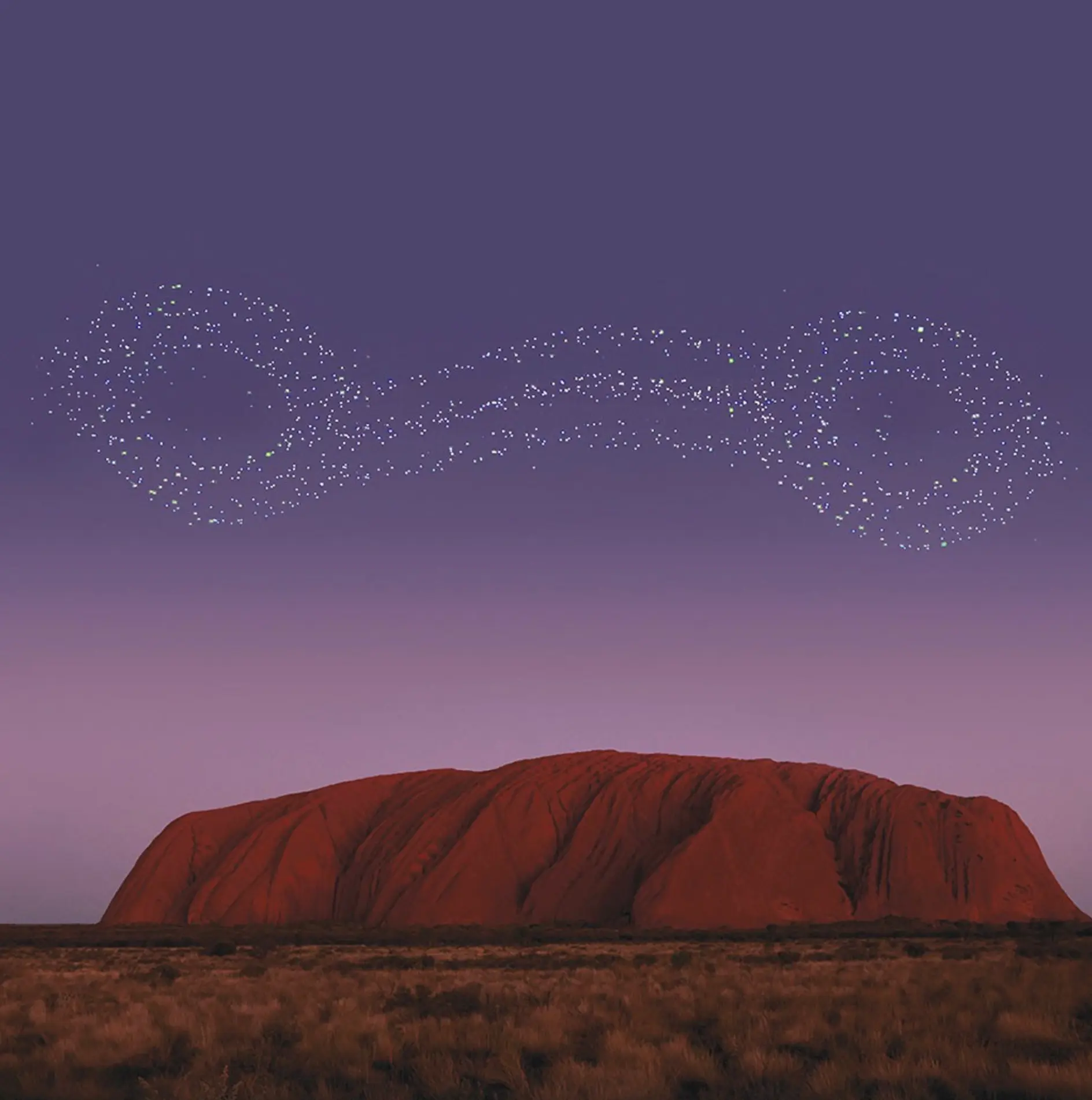
- The rock changes colour — fiery red at sunset, deep purple after rain
- The surrounding area is home to dingos, thorny devils, and over 150 bird species
- Its name was officially restored to “Uluru / Ayers Rock” in 1993 to honour its dual heritage
Final Thought
So yes — Uluru might run deeper underground than most of us imagine. But its real depth? That lies in its cultural significance, its stories, and the way it grounds you when you stand at its feet.
If you’re planning a visit, don’t just aim for a good photo. Come with curiosity, respect, and time to walk slowly.
And if you’re after something beyond the basics, reach out — we run small-group eco tours that give you space to really listen to the land.
FAQ
Is Uluru really 90% underground?
No. While it does extend underground, the 90% figure isn’t backed by scientific evidence. It’s more a way of saying “there’s a lot more below than you think.”
Can I go underground or see the buried part?
Nope. There are no caves, tunnels, or tours that show the underground structure. What lies beneath is solid rock — not some hollow system.
Is Uluru connected to Kata Tjuta underground?
Geologically, yes. Both are part of the same sedimentary basin and ancient uplift, but they’re not directly connected like a tunnel.
What’s the best way to learn about the real stories of Uluru?
Join a cultural walk with Anangu guides or rangers. The Mala Walk and Kuniya Walk are rich with insight and respect.
Why can’t we climb Uluru anymore?
Climbing disrespects Anangu cultural law and has been discouraged for decades. The climb was closed in 2019 after years of requests by Traditional Owners.